

3D laser scanning can also be used for heritage surveys and conservation surveys, as well as volumetric surveys, where land/material mass can be calculated to create a desired outcome – for example, providing accurate areas of volumes for cut/fill balancing, or creating a mound or depression in the land to suit your design needs.
What is 3D laser scanning?
Whether you want to capture the 3D geometry of civil infrastructure, create a 3D as-built representation of a large and complex building, reconstruct a crime scene or generate 3D data for integration into Building Information Modelling (BIM) software, a scanned survey is the right choice to deliver millions of detailed and accurate geo-referenced points.
3D laser scanning really comes into its own when complex or large environments need to be accurately surveyed and documented. Prior to the introduction of industry-leading products to process point cloud, traditionally, capturing large environments relied on tools that produced single point measurements. These included tape measures, piano wire, plumb bobs, laser range finders and total stations. You had to be very sure of what areas of the site you were picking up as using a total station meant that only certain points within the site would be picked up. If another area of site needed to be picked up, it meant going back to site to collect the data.
Total stations, and indeed tape measures, are still important tools within the surveying profession for capturing data in areas with a large amount of scrub or on large tracts of land. However, for complex sites with a lot of detail to be collected they can be time-consuming to use and potentially not provide the level of accuracy required. In contrast, laser scanners can capture millions of discrete data points. They measure an object or space using laser infrared technology that produces detailed 3D images rapidly. The images comprise millions of 3D data points, known as a point cloud and through computer processing, can be transformed into 3D models to aid communication, discussion and collaboration.
How does 3D laser scanners work?
3D laser scanners measure distance and capture measurements on the horizontal and vertical planes, to provide the full spectrum of measurement data. The scanning works by emitting a beam of infrared laser light onto a rotating mirror that effectively paints the surrounding environment with light. The scanner head rotates, sweeping the laser across the object or area. Objects in the path of the laser reflect the beam back to the scanner, providing the geometry that is interpreted into 3D data.
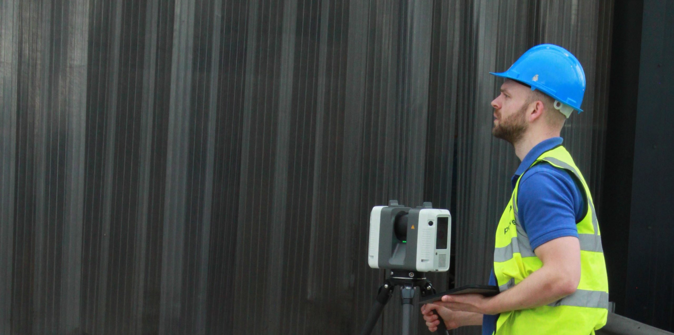
Powers, laser scanning in brief
At Powers, we provide 3D laser scanning services and point cloud data sets. Our laser scanners enable data capture at one million points a second and comprehensive raw point cloud data. Comprehensive raw point cloud data equates to no site returns as all data can be collected quickly and easily first time round and our data is available for use at the touch of a button. With an experienced team in place, we can easily convert the point cloud into a 3D model, which helps provide project teams with a greater understanding of their project and encourages extensive digital collaboration.
Our laser scanners can cover vast swathes of land or buildings quickly, which reduces the time required on site – with its associated health and safety implications – as well as the total project duration and the cost to our clients. With the capability to capture difficult to reach areas remotely, health and safety risks are reduced here too. 3D laser scanning can assist with on-site logistics and allow designers to gain valuable data, such as adjacent building heights or obtain vital dimensions for planning purposes, before a project starts.
For further information on 3D laser scanning, visit Powers UK.


