

SERVICES
Setting Out for Construction
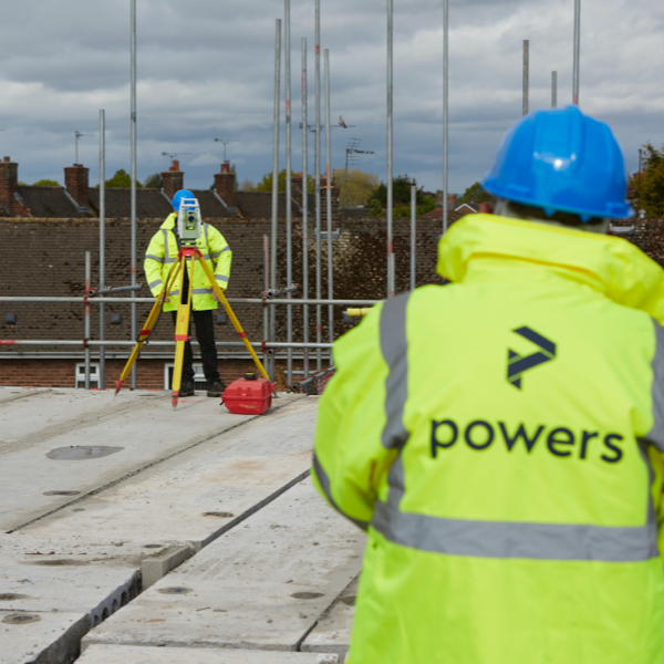
Absolute accuracy when setting out buildings or infrastructure is crucial. Our experienced and dedicated site engineers ensure that all setting out is implemented with precision and efficiency, using a combination of Leica robotic total stations and GPS equipment.
Ensuring we have the most up-to-date version of a site plan and that the building coordinates are calculated correctly and uploaded onto our Leica Total Stations – rather than calculated by hand – helps safeguard against human error and guarantees accuracy. The proposed site layout is based on the same grid as the original topographical survey. From this we can extract coordinates for the building corners. Using an electronic theodolite referenced to existing site control, we can then peg out the required corners.
Key Benefits
- Precision accuracy in setting out
- Our meticulous record keeping gives us an accurate historical picture of how a site was developed
- All total stations are calibrated annually by an external agency. Tribrachs and levels are subject to rigorous tests on a regular basis
- Drawings are checked and overlaid on top of the topographic survey to ensure that any discrepancies are easily detected prior to a site visit
- Using the total station with uploaded coordinates, our land surveyors can easily set up a network of control stations and reference objects, to set out the points required on site
- Once work has been completed, our surveyors will check that the position of the building is in line with the design and layout of the plans
- To ensure accuracy, coordinated points of the building are checked by tape measure at random intervals, to ensure that the size and shape of the building is correct
Deliverables
- Setting out for individual building plots for residential clients leading to more complex multiple plots for house builders
- Setting out for large scale apartment blocks, commercial property, hotels and office buildings
- Setting out for roads and highway infrastructure
- Setting out for sewer lines
- Setting out for drainage schemes
- Setting out for complex steel frameworks and checked for precision building

We always strive to work with local businesses, and Powers has continually been able to deliver excellent surveys for our projects. The company’s background surveys – be it the restaurant, gym or more recently the spa – ensure that the project has a solid grounding from the outset and are the origin of how the projects then go on to take shape.

Get in touch
Need a quote or some more information? Call 01928 734 473 or send us a message via the form.
* INDICATES REQUIRED FIELDSurvey Partner All rights reserved.
© 2026 PowersUK Ltd


