

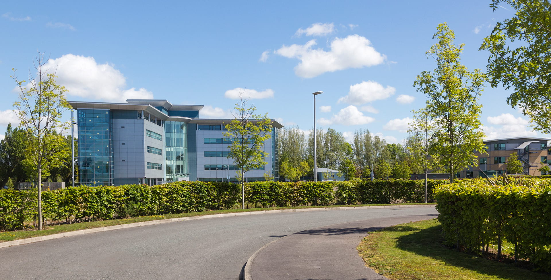
Project: Atlantic Park
Location: Bootle, Liverpool
Powers’ involvement: Topographical survey
Project completion: Early 2024
About the project
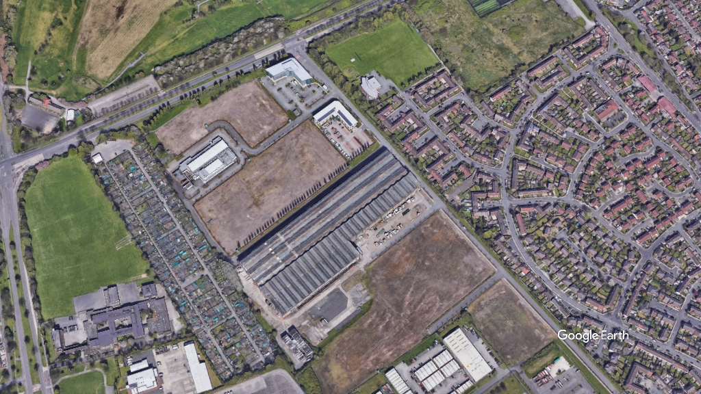
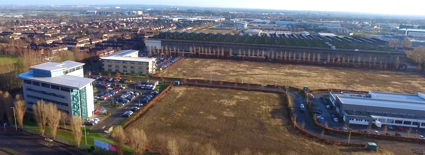
The proposed development plan is for two logistic warehouse units for B2 (general industrial) and B8 (distribution or storage) uses. The area is currently made up of empty fields, which is where the proposed logistic units will be constructed. There will also be site access to the new units, parking, service yards (a yard that is utilised for storage of materials or vehicles) and landscaping of the grounds.
These proposed units represent Phase 1 of the future of Atlantic Park development, which will see the Rolls Royce factory, which is known as ‘Big Foot’, being demolished. Big Foot is viewed as an eyesore that deters from the attractiveness of Atlantic Park to other businesses in the Liverpool area. The Rolls Royce factory, which closed its doors in 2007, will be replaced with a modern, sustainable, and fit-for-purpose building.
Our involvement
At the initial stage of the design, the Client only had a hand-drawn, feasibility survey on which to communicate their plans and ideas. In order to create their designs, the Client had to ensure they had all the correct spatial data. A detailed topographical survey was required to show the boundary, features, and levels of the land. The Powers team were able to support the Client by carrying out a detailed topographical survey providing them with a drawing that identified all the vital features of the site, for example, levels, boundaries, manholes, trees etc. This allowed the Client to make plans for groundwork and to position their designs according to the lay of the land.
The topographic survey also allowed the Client to give contractors key information, such as specific coordinates for groundworks and building positions, and the drawing can also be shared and used across the design team and by different consultants and construction contractors.
The Challenges
The initial scheme sketches were drawn by hand and based on an ordnance survey map (also known as a feasibility study). There was no clear detail, and this drawing was less accurate and detailed than a topographic survey. The original drawing didn’t show many features, such as ground levels, service manholes, trees, surface changes, existing building information, and boundaries, all information that needs to be considered in the design of a new scheme
The spatial data collected by Powers for the topographic survey meant the Client were able to determine the extent of the existing buildings, trees, and landscape, and pinpoint with accuracy the manhole locations, to help them locate underground services.
The team at the Client were able to determine floor levels of the existing buildings and to see if the scheme required any retaining walls. The Client will retain some of the existing buildings in the new scheme, and the topographic survey was able to place all existing infrastructure, kerbs, and street furniture.
Having the Powers team locate the perimeter of the site gave the Client important information to see the extent of the site.
The topographical survey completed by the Powers team meant the Client were able to create a detailed scheme with exact measurements, ready to be sent to their client. This drawing would then become the base plan for all future construction work.
The outcome
Atlantic Park will attract a large number of new enterprises to the business park enabling it to flourish and boost the local economy
Powers has enabled the Client to submit a planning application for Atlantic Park. The Client can be sure that the Powers’ survey is complete, accurate, and contains no gaps with detailed information across the site.
Phase 1 of the project is expected to cost around £14 million altogether, and it will likely be finished in late 2023 or early 2024.
Quote
Louise Jones, Architect, The Harris Partnership – “I have worked at The Harris Partnership for 10 years and I am the lead on various projects, which include retail and commercial to industrial and logistics. We’ve worked with Powers on a variety of different projects, using the many services they provide. They always provide a high standard of work and have a great, friendly team. The work the Powers team did on Atlantic Park was extremely beneficial to us, as we were able to create accurate drawings based on the information provided.”
If we can support you with a topographic survey on your site, fill in our contact us form for a no-obligation quote.


