

Project: A34 Major Roads Network Corridor Improvement Plan
Location: Stockport, Greater Manchester
Powers’ involvement: Topographical and underground utility surveys
Project completion: November 2022 to October 2023
About the project
The improvements are designed to support:
- sustainable travel, with a 5.6km pedestrian and cycle route along the A34 corridor. This includes a segregated cycle track and controlled crossings with connections to the wider Greater Manchester Cycle Bee Network and local public rights of way
- businesses with works to improve access to the Cheadle Royal Business Park and the Stanley Green business area, by improving key junctions and providing better walking and cycling access
- new homes and development with improvements to junctions, to provide access to, and mitigate against the impact of, any new housing development on the local road network
- education with the replacement of an existing subway beneath the A34 at Kingsway School, to provide a better link for the split school site and allow for a key east-west cycle route
- motorists with improved junction layouts to reduce congestion, improve safety and provide enhanced driver information on new variable message signs.
The Government approved funding for the delivery of this project, once Stockport Council submitted its business case to them in 2023. The improvement works based on Powers topographical and underground utilities plans will be delivered in phases and will be scheduled and co-ordinated to minimise disruption as much as possible. The council is planning the first phases around Gatley Road, Wilmslow Road and Broadway at the beginning of 2024.
Our involvement
Following a tender process, Powers successfully secured a place on the Topographical Survey Framework with Stockport Council, run through STAR procurement. Powers was selected based upon its evidence of the social value it will add to Stockport’s community and the social value it currently adds to its own community and profession, as well as the impressive case study-based presentation which outlined its experience, capability, risk assessments and methodology.
As part of the framework, the survey team was commissioned to produce a series of topographical surveys and underground services detection plans – also called a Ground Penetrating Radar Survey (GPRS) – of a 10 mile stretch of the highway route.
A survey of the full length of the road, had been carried out to secure funding for the £35 million project. However, additional topographical survey and GPRS of a 10-mile section was required for a proposed cycle lane for this stretch of the road. The survey involved the main carriageway and outside the highways.
This detailed survey mapped data such as routes and contours of the highway, but also visible physical features. The underground survey plotted features such as surface water drainage routes, sewers, electric utilities and other features. Underground survey equipment used radar to locate and chart subterranean obstacles and features with extreme accuracy. This enabled the data to be analysed digitally and create imagery and maps.
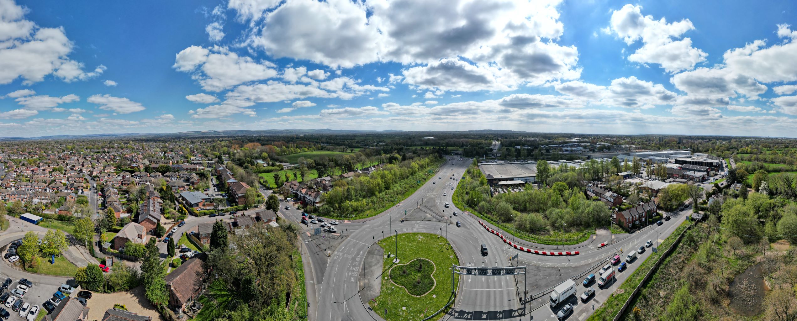
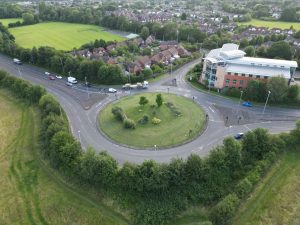
The challenges
The main challenges were carrying out surveying work on a busy highway. There were constraints around the surveying project, involving the busyness and number of users which were present when the surveys were taking place. This was mostly vehicular, but also pedestrians in some sections. This was especially true at times such as the school runs and rush hour. The A34 is a busy, well-used road route in general, prone to motorist congestion, and a high level of vigilance and regard to health and safety was required throughout the survey period.
Another challenge was the surveys’ very quick turnaround, as traffic management was required to access some of the areas. This had to be organised in advance and the survey work carried out in a timely, precise manner in order not to extend costs via surveyor labour or traffic management. To help address the challenges around traffic management some of the surveying work was carried out over the weekends when the roads were quieter.
The outcome
Powers’ surveyors have a great deal of experience of working within constraints such as the level of traffic and the project management and planning that is needed in such cases to co-ordinate survey teams.
While two different teams carried out the topographical surveys and underground services detection plans, they both used the same existing station control, which was established using previous survey data at the start of the project. This ensured that there was a single version of truth. The two teams also used the same traffic management and road closures, so help minimise the disruption to the road users.
Once the topographical survey was completed, the underground services detection team used the completed survey as a drawing to overlay the utility information onto.
There are 12 schemes associated with the Improvement Plan in Stockport and the first has now commenced at Gatley Road, Wilmslow Road and Broadway. Works will continue over the next couple of years. The improvements made to the A34 will provide benefits in the coming years, for future generations, especially involving social value. Local authorities need to provide sustainable value for the future and schemes such as this high improvement project deliver this for residents and users alike.
“We have worked with Powers in the past and know exactly what we are dealing with, when it comes to their professionalism and expertise. The A34 MRN Improvement Plan is a complex, farsighted and forward-thinking project that will deliver important advantages in the future. Powers’ working methods easily met the challenges of the project and gave us key insights into the nature of the highway and its many facets, allowing us to design and plan the best solution.”
Tom Williams, Stockport Metropolitan Borough Council


