

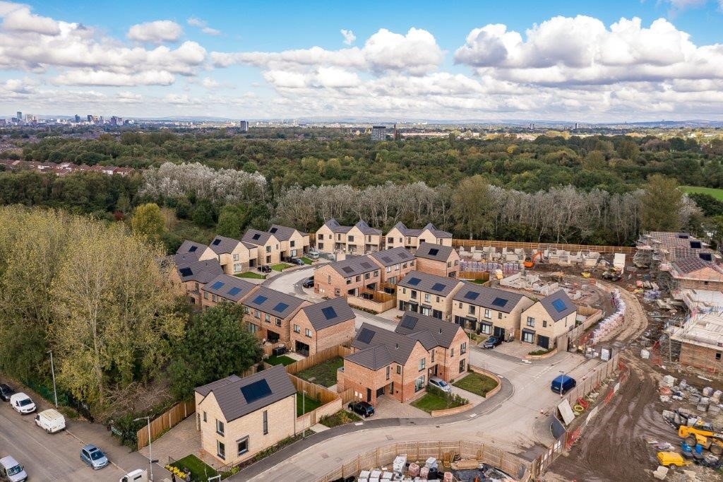
Project:
Shores Fold, Cringle Road
Location:
Cringle Road, Levenshulme, Manchester
Powers’ involvement:
Topographical survey along with site engineering on the new access road and setting out of plot positions.
Deliverables:
- A digital drawing of the features and levels of the site for design development.
- Site engineering for the installation of the new access road.
- Setting out plot positions, including ‘as built’ drawings, ensuring risk of error is minimised through complex calculations on site following design updates.
Project completion:
January 2026
About the project
The location and accessibility of this new development is one of its major benefits. The homes are already in high demand with buyers locally within Levenshulme, The Heatons and South Manchester, as well as relocators from other parts of the UK. The development is conveniently located for easy access to the motorway network, providing commuter links across the wider North West. It is on a cycle route, which directly links to the Fallowfield loop for green travellers, and a short walk from main routes for public transport into Manchester, Stockport and beyond.
Our involvement
The Powers team was commissioned by the property developers, Cringle Rd Developments, at the start of the project to undertake a complete topographical survey of the site. The detailed survey picked up all the features on site to give an accurate and visual indication of what features, ground levels and challenges their client’s site team may encounter, allowing them to problem solve and de-risk the consequences of errors on site before they had set foot on it.
In addition, the site engineering included the setting out of the plot positions for the housing over a three-year period. Coordinates were calculated within CAD applications and uploaded to the Powers’ site engineers Leica total stations prior to visiting site to eliminate manual input errors.
Powers provides many of its clients with site engineers that can be booked out on specific days to suit the timelines of construction on site. This has been a game changer for many construction clients who don’t want to employ a site engineer full time but need this specialist expertise at certain phases of groundworks and site development.

The challenges
The biggest challenge for the topographical survey was the coordination with other contractors on site. All Powers’ total stations are professionally calibrated annually, to ensure consistent accuracy.
A Leica TS 16 total station was used to carry out the topographical survey. The plot positions were set out using a Leica GPS GS07 GNSS to Ordnance Survey grid and datum, while a pipe laser was used to identify the gradients, distances and levels – within 10 mm – to the 600 manholes, as GPS equipment would not have been accurate enough.
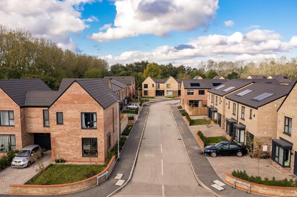
The site engineering on the road and the drainage was significant. The work had to meet S278 requirements. Planning requirements meant that the properties needed to be constructed to damp proof course (DPC) level before the road was able to be installed, so ‘as built’ drawings were required to enable the new houses to be connected to the mains after the road was complete.
A programme of works enabled this to be coordinated and Powers’ site engineers were available throughout the project to ensure the successful progression of the development. Powers site engineers reviewed and re-checked the construction drawings for design changes, movements to plot positions or changes to the direction of the drainage on site, providing drawing verification and overlay. The total stations were used to establish control points and reference markers, ensuring precise placement of all building elements.
Being flexible and on top of the many drawing revisions, along with the accuracy of its setting out – therefore, reducing errors on site – was key to the site engineering team’s success. In addition, after setting out, the site engineers verified each building’s position to ensure it aligned perfectly with the design. This included distance from fixed boundaries, placement relative to roads, drainage, or other structures and orientation within the site.
The outcome
Powers worked seamlessly with the Cringle Rd Developments’ team to provide setting out expertise and expert technical know-how at the exact point that it is required in construction to prevent delays, errors in construction or uncertainty. The team’s setting out of the plots was completed in 2023 and through ongoing liaison with the council and Highways, ensured that the road was signed off in 2024.
Powers also provided Cringle Rd Developments with a full topographical survey to use as the base plan for the architectural drawings and then the preconstruction drawings. By being able to provide the company with highly skilled site engineers as and when required, Cringle Rd Developments was able to save on the cost of an employed, full time site engineer who may not have had enough work, and spend on this specialist expertise at specific intervals in the development. In addition, having site engineers on site at key times in the build meant that inaccuracies were dealt with immediately and errors avoided. All of this ensured the build was not held up by site survey errors, confusion or engineering inaccuracies.
Powers carried out the work in a professional and timely manner, with both speed and attention to meet the exacting requirements of the on-site site engineers.
Nick Maskrey, Managing Director at Cringle Rd Developments, commented: “Shores Fold development continues to evolve and we have now completed Claypit Cresent in its entirety. This includes 43 new three- and four-bedroom homes. Brickyard Close is now also well under construction and we are on target to deliver the remaining 14 homes by the start of next year. The topographical surveys Powers completed at the start of the project – and the team’s ongoing site engineering work with the access road and setting out – has all helped us continue the development at a pace.”


