

What is drone surveying?
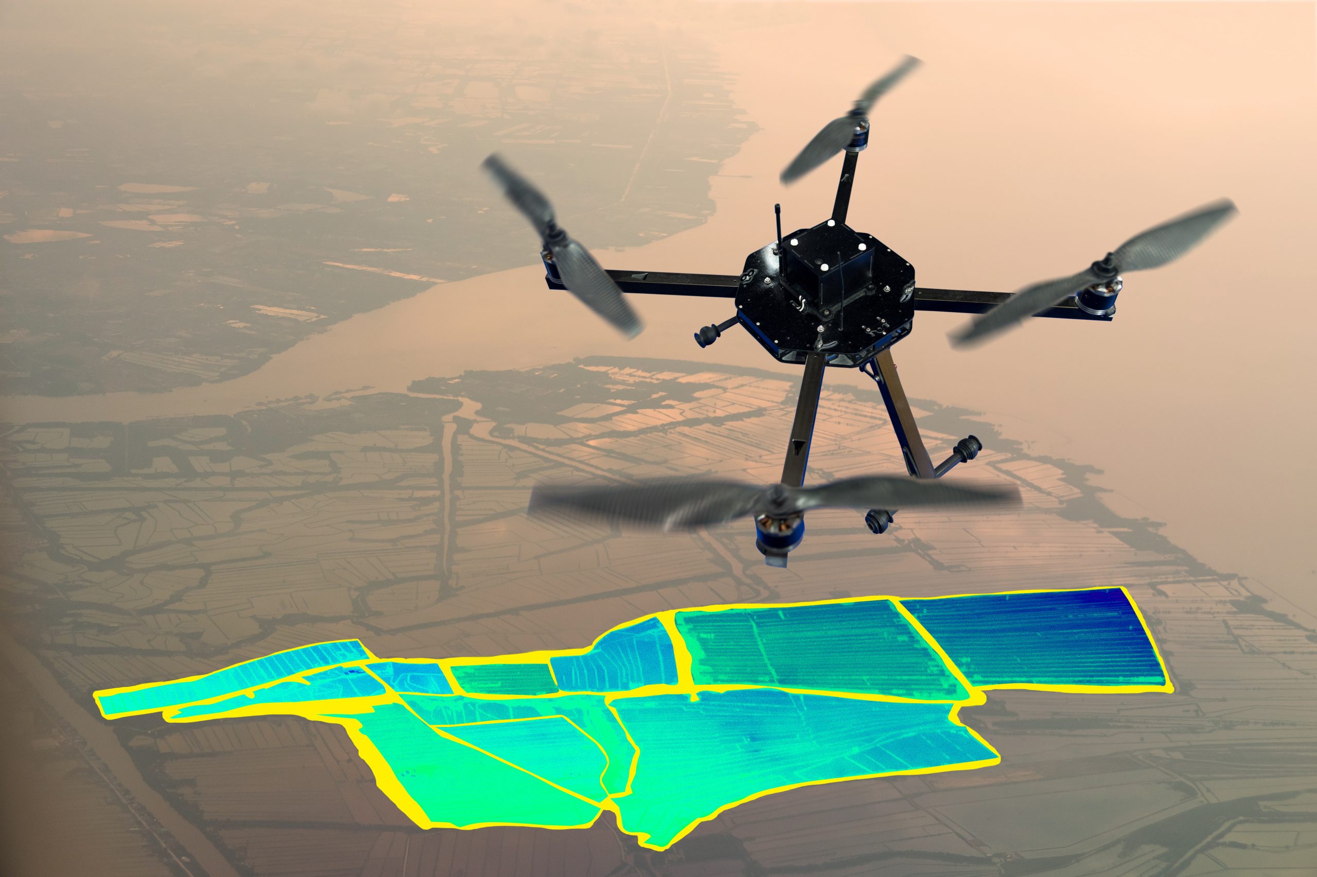
The method of gathering data from an airborne vantage point is drone surveying. By using a high-resolution image, the photos can be stitched together. These images each carry a set of 3D coordinates, which enables further processing to assemble them into a sketch. Autonomous drone mapping is the use of a drone to immediately produce drawings. You can read more about drone surveying in our article here, which goes into more detail about drone surveys.
Why would I need a drone survey?
Drones are a great way to gather a lot of data all at once and cover a vast area. If you have a large site and the ground needs to be covered rapidly, a drone survey is a huge advantage. Once the data has been collected from the drone in a point cloud format, it is safely stored in The Cloud and is then available to be downloaded and processed.
What is a topographical survey?
A topographic survey collects information about the land’s natural and man-made features, as well as its contour. The ground and its limits are precisely defined by permanent objects like structures, fences, trees, and streams. Spot levels and land contours display the height of the terrain. A topographical survey is extremely thorough.
How are drones being used for topographic surveys?
Drones can use LiDAR or photometric techniques to survey the land from the air. From this point, the data can be transformed into a 2D or 3D model and sent to clients. They can access places that humans cannot. By undertaking a topographic survey, you would obtain more information more slowly. Drones can save money since they require less time on-site than traditional surveying methods.
Do I need a topographical survey if I’ve had a drone survey?
You get more information from a topographic survey than you might from a drone. Drone surveying would be the perfect tool to use while preparing a feasibility study. Using a total station and GPS is more suited if the detail is crucial. While not appropriate for all surveys, drones are being increasingly used in surveying.
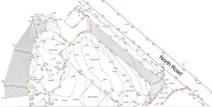
Topographic survey example
The example below is a topographic drawing created by the Powers team. This topographical survey drawing depicts all the area’s contours and details; however, it can be less visually appealing than a drone survey. A feasibility study with a drone is excellent, but there is little information, and it may not be as accurate as a topographic survey. It’s possible that characteristics like ground levels, service manholes, surface changes, and boundaries won’t appear on the drone survey drawing. Planning and designing a new location require all this information, including the ability to find underground utilities.
At Powers, we can collect a variety of data using different surveying methods, check out our services page to see what we can offer you.
Contact us today for a free quote by ringing us on 01928 734473 or fill out the form below to learn more.


