

Sadly, women are still woefully under-represented in the geospatial arena. According to recent Royal Institute of Chartered Surveyors (RICS) data (February 2022), women represent only 18% of RICS’ 139,000 international professionals across 23 pathways, and the latest figures from Chartered Institute of Civil Engineering Surveyors (CICES) suggests that women make up 15% of its membership, (globally, women make up 40% of the workforce). However, it is a profession that can equally suit entry from all genders, and once qualified, the salary and financial benefits are good too, with experienced surveyors being highly sought after.
What is geospatial surveying?
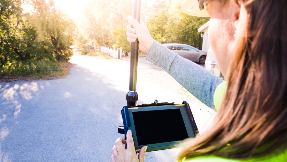
Geospatial, or land surveying, is the measurement and mapping of our surrounding environment using mathematics, specialised technology, and equipment. Surveyors can – and do – measure just about anything. The results can then be used to establish boundaries of an environment and understand the relationship between what you can see and also what is happening beneath the surface – making it easier to decide on a project’s direction.
Outside in
Due to the inherent outside nature of a surveyor’s job, a key attribute that is absolutely essential is a willingness to work outside regardless of what the weather is doing. In fact, although very high winds can sometimes make it impractical and unsafe to carry out work at height, there is very little that stops work taking place. Not all work is site-based, but in general the data gathering is carried out in-situ, so the role is suited to people who like spending time outside and who are used to working in extremes of weather.
However, it is not only the working environment that can be appealing. The work itself is varied and often surveyors can find themselves in vastly different environments day on day. From working in a remote or rural location, to busy city centres or even highways, depending on the survey requirement, will depend on the location across the UK or worldwide.
Innovation at the outset
Survey technology is continually evolving, and new innovations are reaching the market every day. Surveyors that find themselves working with a forward-looking company, will have the opportunity to work with the latest technological innovations in modern surveying equipment and software. These can range from cameras, lasers, global positioning systems (GPS), geographic information systems (GIS) and software that creates accurate 3D environments that would look more at home in an online gaming environment.
Interested?
There are many pathways into the geospatial profession. Apprenticeships are proving to be an increasingly popular route. Apprentices work towards industry-recognised qualifications and benefit from things like mentoring and knowledge-sharing throughout the journey.
Lucy Powers, director at Powers UK and co-chair of the geospatial apprenticeship trailblazer group, explains: “Apprenticeships work well for both the apprentice and employer. A Level 3 geospatial technician survey apprenticeship provides apprentices with the knowledge of how to use the equipment, capture data and process it in the office – along with equipping new employees with the softer skills of how to work in the construction industry, how to find a site, how to talk to clients, how to problem solve and be confident in their skills and abilities.
“So, apprentices learn skills and a ‘trade’, while those providing instruction and guidance can learn new methodologies and approaches – due to innovations in the industry and progress in training. Like the wider construction industry, the profession is also suffering from a skills shortage. Good geospatial mapping skills are desperately required in survey companies like ours and apprenticeships are the ideal way to create the surveyors of tomorrow and sustain the survey profession for generations to come.”
If you would like to find out more about a career with Powers, visit: www.powersuk.com/careers


