

The Land Registry office is the go-to authority when it comes to finding out about title deeds, land ownership and other land-related queries. The Land Registry’s Title Register holds data outlining a description of each UK property, who owns it, who the relevant mortgage lender is, and the price paid or stated value (if registered since 1 April 2000). It also details any rights of way (not public rights of way) or other rights affecting the property or other conditions. A second document, the Title Plan, illustrates the extent of the property, with the plot it stands on and its boundary outlined in red. It also uses other colours to indicate rights of way, general boundaries and land affected by covenants. For example, areas of land removed from ownership are indicated on the plan in green. With the Title Register, it is the other official document proving ownership of a property and its plot. Both these documents can be accessed online and be applied for directly from the Land Registry office.
Uncharted territory
If you have all the official documentation and proof of ownership, there can be little dispute about boundaries. But when ownership of a boundary cannot be proved, or when there is an ongoing dispute over ownership, things become more complicated. Boundary disputes can be costly, time-consuming and stressful. According to the Land Registry, it is actually very difficult to find out the exact position of a boundary. The majority of registered land and property in England and Wales is registered with General Boundaries. Once the land or property is registered, it creates a Title Plan, which whilst being as accurate as possible, does not show the precise position of the boundaries and cannot be used to establish exact boundary positions.
A legal boundary is an imaginary line that separates one piece of land from another. It does not have thickness or width and is rarely identified with any precision either on the ground or within the title deeds. A physical boundary is a feature that can be seen – such as a wall, fence or hedge. The legal boundary may follow any physical boundary structure, but can just as easily run along one particular side of the fence, wall or hedge, or can even include all or part of an adjoining road or stream. However, you can fix your boundaries more precisely by sending the Land Registry a very precise plan showing where the exact line of the boundary is, using Form DB. This procedure is known as ‘determining the boundary’.
Surveying the situation
Ordnance Survey (OS) plays a key role in establishing boundaries and works closely with the Land Registry office. Together they indicate the general boundaries of a property or area, when the land was first registered. OS make maps of Britain showing every type of geographic and topographical feature, historical and natural sites, and roads, waterways, railways and buildings. Walkers, cyclists and ramblers rely on OS maps to navigate the remotest parts of Britain’s hill and coast, but OS’s highly detailed charts are also used for Title Plan registration. It should be noted however that boundaries shown on OS maps aren’t legally-binding.
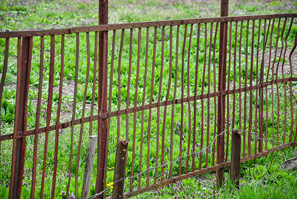
Even with OS constantly updating their maps, the OS map/Title Plan of your property may be a misrepresentation of what is actually present on the ground. It’s important to remember that if a wall or fence has been erected by a new owner, or a hedge has been planted, this might not be the exact location of the boundary. It’s quite a common occurrence for an owner to creep with a fence or hedge, either inadvertently, or to purposefully pinch a bit more extra land beyond their actual boundary. Just because a fence or wall has been erected doesn’t mean it is the boundary to your property, or that it will be automatically included in your Title Plan or on an OS map.
At Powers, we can help with a range of land-related issues. These include determining individual parcel boundaries, the subdivision of land, the provision of lease and conveyance plans, boundary demarcation, assessment of land for sale, and the resolution of boundary disputes. Our experienced land surveyors can be expert witnesses for boundary resolution, where our fair and honest viewpoint will help prove and win your case. We can collate documentation and other evidence, and guide you through the application process, to establish that boundaries are where they are supposed to be. If you would like to define your plot’s boundary, or are involved in an unresolved boundary dispute, then call 01928 734473 and speak to Matthew Powers who would be happy to discuss solutions to your queries today.


