

Project: Reddish Vale Reservoir
Location: Reddish, Greater Manchester
Powers’ involvement: Topographical Survey
Project completion: April 2023 (Powers part in the project)
About the Project
Within Reddish Vale Country Park there are three designated reservoirs. Two ponds, which are available for angling, are part of the Canals and Rivers Trust. Powers was required to look at the older reservoir, a former millpond. Reddish Vale is mainly green space, comprising woodland, flat riverside meadows, sloping fields used to graze horses and a golf course. It is crisscrossed by a number of footpaths, some of which follow the River Tame. The picturesque area also features a 16-arch brick viaduct built in 1875 to carry the railway line, which is now a public bridleway.
The area is steeped in Industrial and post-Industrial history. Nearby are two mill ponds left over from industrial activity in the vale. The ponds were fed from the river above a weir (destroyed in floods in the 1960s) which provided power and processing water to Reddish Vale Print Works, a calico printing works which has now been demolished and the land turned into a butterfly park. The ponds are now used for angling and attract wildlife. Originally a cornmill was sited over the brook and was demolished in about 1860, when the ponds were extended, so the site includes a number of interesting features.
Our involvement
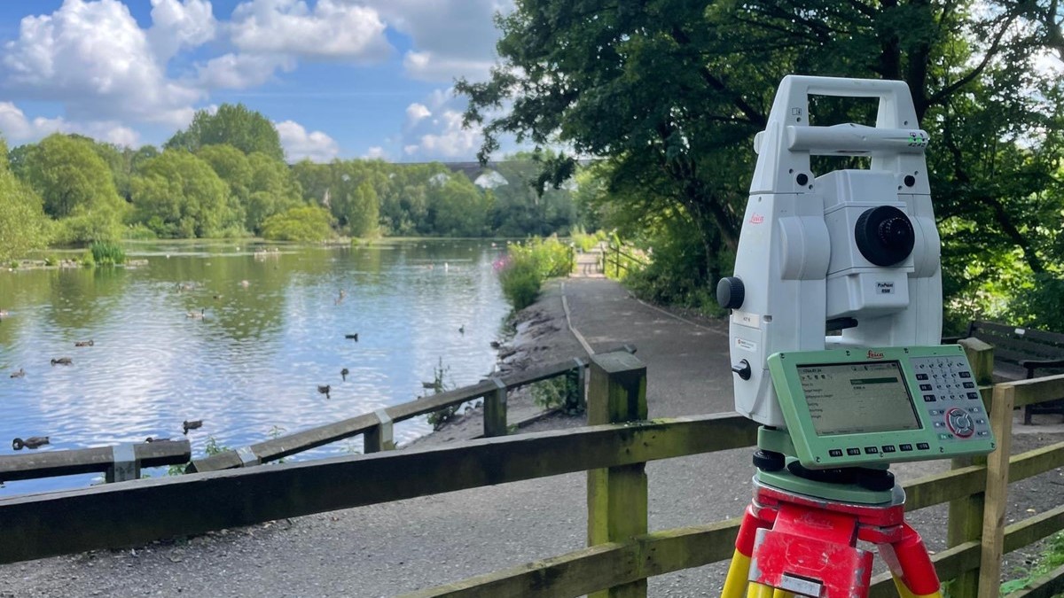
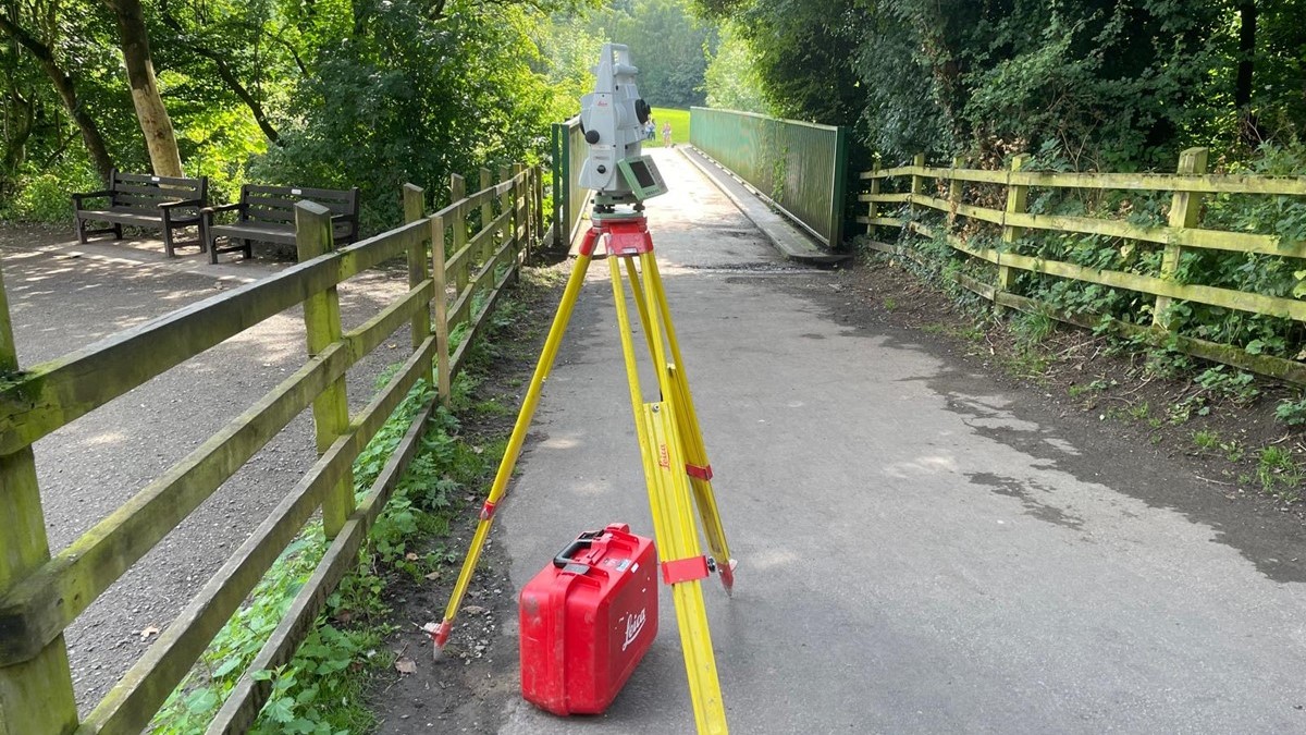
Powers was required to carry out surveys on the older reservoir. The Powers team was engaged as part of their ongoing collaboration with Stockport Metropolitan Borough Council, as a framework survey partner.
Powers has been involved with the Stockport Council framework on various projects, including the A34 Major Roads Network Corridor Improvement Plan [link]. This project couldn’t have been more of a contrast with that project, with the peace and tranquillity of the Country Park very different to the busyness of the A34 corridor. Powers carried out a topographical survey of the reservoir and its surroundings to measure the site. The data collated built up a picture of the relationship between the reservoir and the landscape. For example, if the reservoir burst its banks, what impact this might have on smaller structures nearby. The reservoir is also close to the river, which presented the possibility of flooding.
The challenges
The site wasn’t easily accessible, as it is countryside with a rural post-Industrial landscape. The Powers team had to be careful on the site and look out for natural hazards – such as potholes and uneven terrain – and also safeguard the environment so as not to disturb the location’s natural inhabitants whilst carrying out the topographical survey. The team carried out all the necessary Risk Assessment and Method Statements (RAMS) to identify areas of risk and mitigate against specific threats posed by working on such a site.
The outcome
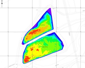
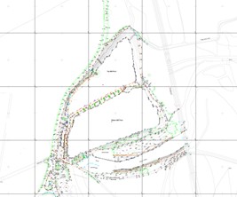
The results of the topographical survey carried out by Powers can now be used by Stockport Council going forward. Data gathered indicates how the reservoir site looks now, including all geographical, natural and manmade features. This can be used to ascertain the reservoir and site’s potential in the future, and also be used for the conservation, preservation and restoration of the location’s wider area.
Tom Williams, Stockport Metropolitan Borough Council, said: “We have worked with Powers on a variety of different projects, in a wide range of different geographical locations around the borough. The company’s work at Reddish Vale Reservoir demonstrates both its expertise and versatility. The team’s depth of knowledge and reliability delivered exactly what was required of the project.”


