
This site uses cookies. Find out more.
Close menu icon
  • Our Services
        • Land & Buildings

          • Measured Building Surveys
          • 3D Laser Scanning
          • 3D Models
          • Topographic Survey
          • Boundary Surveys
          • Accurate Measured Viewpoints
          • 3D Revit Model
          • Mobile Mapping
          • UAV (Drone) Surveys
        • Site Engineering

          • Setting Out for Construction
          • Machine Control
          • 3D Ground Modelling and Volumetrics
          • As Built Survey
          • Deformation and Movement Monitoring
        • Underground Services

          • PAS 128 Underground Utility Detection Survey
          • Topographic Survey
  • About Us
    • About Us
    • Responsible Business
    • Project Lifecycle
    • Careers
  • News
  • Projects
  • Contact Us
Skip to content
  • Our Services
        • Land & Buildings

          • Measured Building Surveys
          • 3D Laser Scanning
          • 3D Models
          • Topographic Survey
          • Boundary Surveys
          • Accurate Measured Viewpoints
          • 3D Revit Model
          • Mobile Mapping
          • UAV (Drone) Surveys
        • Site Engineering

          • Setting Out for Construction
          • Machine Control
          • 3D Ground Modelling and Volumetrics
          • As Built Survey
          • Deformation and Movement Monitoring
        • Underground Services

          • PAS 128 Underground Utility Detection Survey
          • Topographic Survey
  • About Us
    • About Us
    • Responsible Business
    • Project Lifecycle
    • Careers
  • News
  • Projects
  • Contact Us
Hamburger menu icon

News

Revit LOD Levels Explained

Every successful design starts with reliable existing building information. When architects and civil engineers work from incomplete drawings, outdated records or manual measurements, valuable design time is often spent checking dimensions rather than developing solutions. A professionally surveyed Revit model changes that. By combining high-accuracy laser scanning with survey-led modelling, Powers delivers a trusted digital representation of the existing building that gives your team confidence from day one. Whether you’re testing redevelopment options, coordinating multiple disciplines or progressing towards construction, a well-structured LOD 300 Revit model provides the level of detail needed to design efficiently, reduce risk and make informed decisions. It’s why LOD 300 has become the go-to choice for architects and engineers looking to move projects forward with confidence, accuracy and certainty.

Why choose an LOD 300 model from Powers?

Because it’s the point where survey accuracy meets design usability. You receive a detailed, survey-led Revit model of the existing building with reliable geometry, coordinated building elements and information that can be confidently used for design development, planning submissions, multidisciplinary coordination, quantity take-offs and clash detection. Instead of spending time rebuilding existing conditions, your team can focus on what they do best: designing better projects, faster.
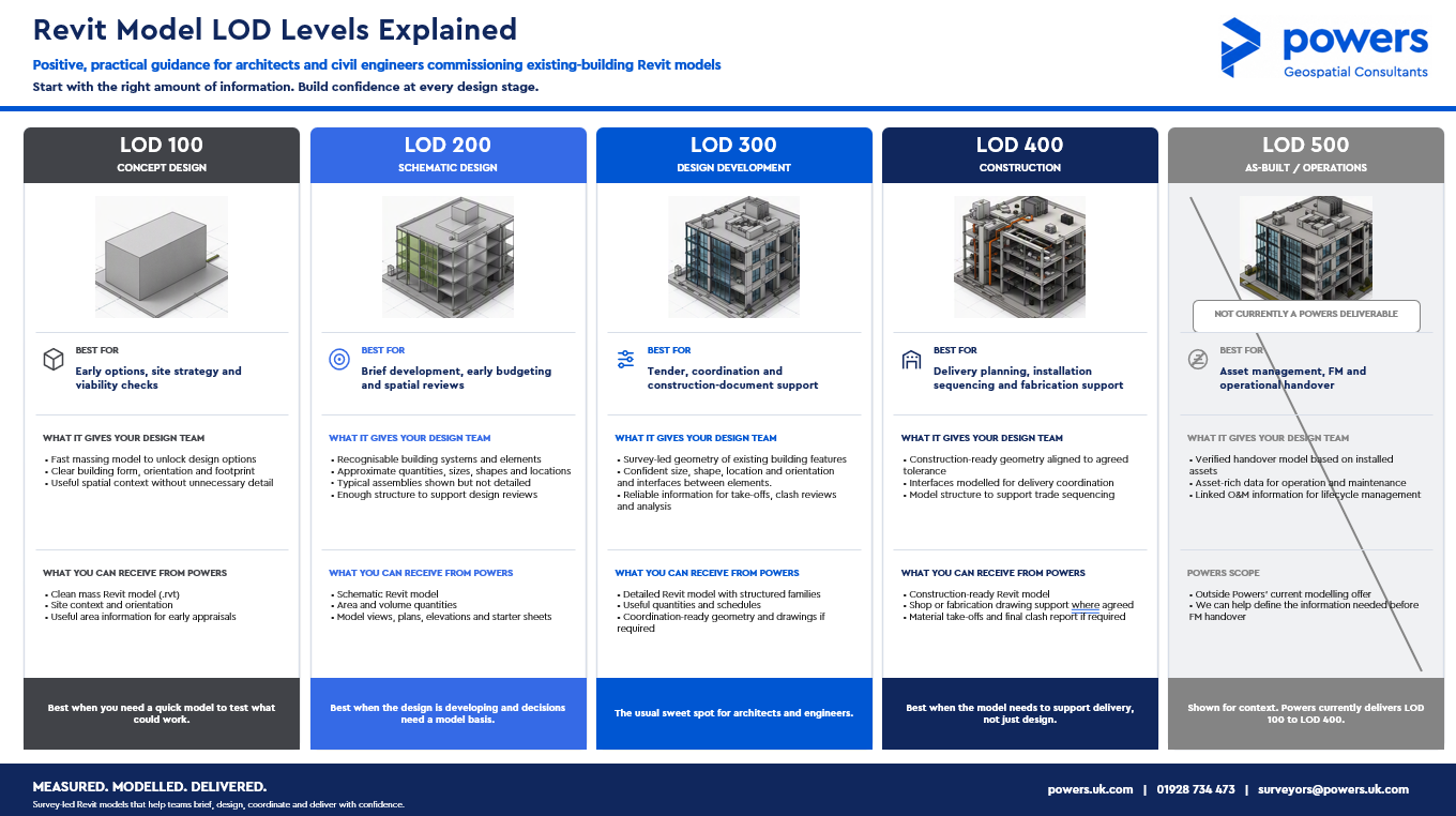
Revit LOD Levels Explained
Integrated
Survey Partner
All rights reserved.
© 2026 PowersUK Ltd

Celebrating 50 years
Subscribe to Our Monthly Newsletter Email
Follow Us
  • Powers on LinkedIn
  • Powers on Twitter
  • Powers on Instagram
  • Powers on Facebook
Terms & Conditions Privacy Policy & Cookies
Website by Stride