

One of the big advantages of digital surveying is that information can be updated and amended at the touch of a button. This can be advantageous when planning a project and also during the construction phase too. In this blog, we’re going to look at why it’s important to carry out up-to-date topographical surveys at various stages of a project – and what can happen if you rely on and use old site data instead.
Invaluable accuracy from surveys
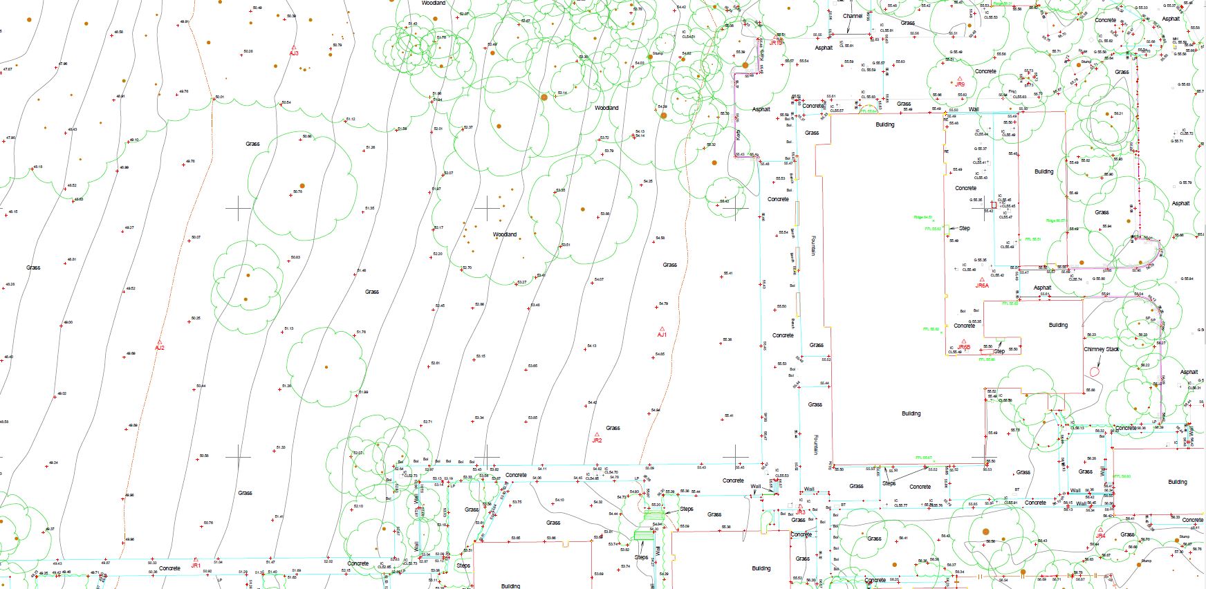
Construction projects rely on exact, accurate measurements, so the type of measurements assessed and collated through a topographical survey is invaluable. Topographical surveys are designed to gather accurate measured data on both the natural and manmade features of any given area of the land. The site can be free of buildings and an entirely natural landscape, or it can have buildings and other features present. Even a seemingly ‘natural’ landscape can over time have manmade features, especially underground. Pipes and cables laid across a site many years ago would be grassed over and invisible to the naked eye today. Like an archaeologist delving into the past, topographical surveys deployed in conjunction with underground utility surveys unpeel the layers to reveal the true nature of the site – and what a construction team can expect to encounter during a project.
Recent developments
Construction schemes and estates naturally evolve over time and this isn’t always due to manmade alterations. The contours of the terrain itself can develop over many years. If you are reliant on older survey drawings or plans, such as hand-drawn maps, historical records and architects’ drawings dating back years, they may be wholly inaccurate today. Moreover, there could be mistakes inherent in these old documents too, possibly as a result of missed features or misinterpretation of the original specification. On site now, we use the most up-to-date and accurate high-precision surveying equipment to map an extraordinarily precise digital representation of the land’s contents and appearance. This collated data can be analysed and interpreted into 3D models and easy-to-understand base plans. Aspects such as boundaries and levels may have changed over time too.
Alterations to buildings will often not have been amended on every record of a site. Roads may have been built, temporary buildings such as sheds might have been erected (sometimes without formal permissions), walls built and hedges or trees planted, which can change the physical appearance and the construction possibilities of a site considerably. All these features will be logged and positioned in an updated topographical survey.
Perhaps the single most compelling reason for not relying on old data and having a topographical survey carried out now is to have a record of the most current version of a site – digitally mapped to the highest accuracy and in a format that can be viewed and shared across multiple platforms and devices. It’s a risky business making decisions based on old, outmoded data. If you would like to talk to someone about having a topographical survey carried out on your site, then get in touch with our surveying experts today: www.powersuk.com.


