

SERVICES
3D Laser Scanning
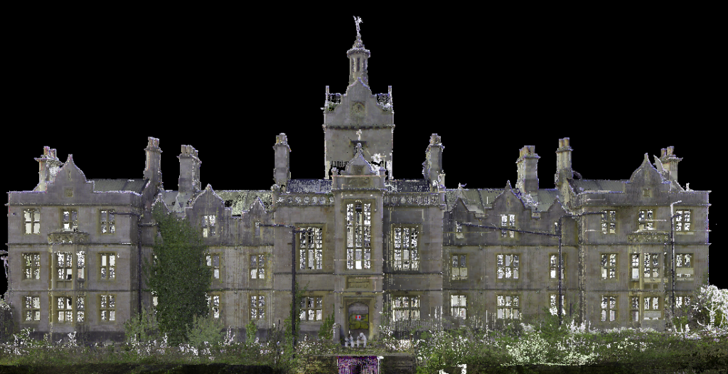
At Powers, we provide 3D laser scanning services and point cloud data sets using industry leading Leica Cyclone and Cloudworx software. With data captured at one million points a second and comprehensive raw point cloud data, this equates to no site returns.
Whether you want to capture the 3D geometry of civil infrastructure, create an as-built representation of a large and complex building (inside or out), reconstruct a crime scene, create a heritage survey or generate 3D data for integration into Building Information Modelling (BIM), a scanned survey is the right choice to deliver millions of detailed and accurate geo-referenced points.
Key Benefits
- Our laser scanners pick up millions of geo-referenced points with millimetre accuracy, giving a precise and detailed picture of what is there
- Comprehensive raw point cloud data equates to no site returns and data available for use at the touch of a button
- The laser scanner can cover vast swathes of land or buildings quickly, reducing the amount of time required on site, the total project duration and the cost to you
- With the capability to capture difficult to reach areas remotely, health and safety risks are reduced
- 3D laser scanning can assist with on-site logistics and allow designers to gain valuable data, such as adjacent building heights or obtain vital dimensions for planning purposes, before a project starts
- The 3D model drawings can be integrated into BIM software such as Revit and AutoCAD Civil 3D
Deliverables
- 3D Building Modelling Surveys (external elevations, internal layouts and building sections)
- 3D models for integration into BIM software
- Heritage Surveys
- Conservation Surveys
- Structure Monitoring
- Volumetric Surveys
- Event Planning

Powers provided us with comprehensive and accurate topographical surveys, on what was an extremely complex area. The information contained in these surveys, including the elevations details, all help us understand the area – and how it can be successfully transformed for future generations – as part of the regeneration project.

Get in touch
Need a quote or some more information? Call 01928 734 473 or send us a message via the form.
* INDICATES REQUIRED FIELDSurvey Partner All rights reserved.
© 2026 PowersUK Ltd


