

SERVICES
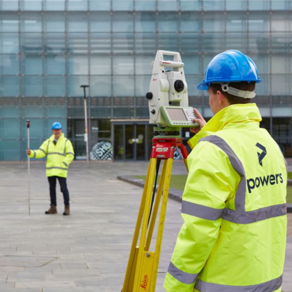
Topographic Survey
We provide accurate hi-tech, high-precision topographical surveys. These are designed to gather data on the natural and manmade features of the land, and the contours of the terrain itself. This data is then analysed and interpreted into a 3D, easy-to-understand, base plan.
What is a topographic survey?
Topographical surveys provide the complete picture of your site above ground. They identify the boundaries of your land, existing building positions on or adjacent to your site, and all the road, path and railway locations. They also feature street furniture, watercourses, underground services, pipelines and trees.
Key Benefits
- When executed at the initial stages of a project, these checks prevent costly delays and help to keep projects on track and within budget
- Topographic surveys highlight issues around actual ground levels versus the proposed design levels
- They identify physical and legal boundaries of the site and ensure that they match up with current documentation
- When carried out in conjunction with our Underground Utilities Surveys, you can get the full picture above and below the ground
- Surveys supplied in BIM (Building Information Modelling) compatible software formats for the crucial first layer of building design
- Post construction or as-built surveys
Deliverables
- 2D and 3D digital base plans
- Global Positioning Systems (GPS) Surveys for surveying large tracts of land
- River section surveys and flood risk surveys
- Proposed Pipeline, Highway and Railway infrastructure surveys
- Surveys for mixed use development plans and commercial or residential planning applications
- Survey for positioning boreholes for geotechnical companies
- Topographic surveys for environmental impact assessments (EIA), land resale, tree surveys or pond, lake and coastline surveys
- All file formats supported

Powers is based locally to Christleton and so the team were already familiar with the area. They provided a detailed topographical survey, which enabled us to develop our plans, which aim to improve the environment and benefit the local residents

Get in touch
Need a quote or some more information? Call 01928 734 473 or send us a message via the form.
* INDICATES REQUIRED FIELDSurvey Partner All rights reserved.
© 2026 PowersUK Ltd


