

SERVICES
PAS 128 Underground Utility Detection Survey
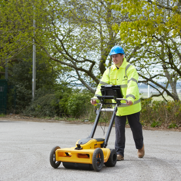
We locate the presence or absence of underground services on sites using ground penetrating radar (GPR) and electromagnetic equipment, such as CAT and genny.
Anybody wishing to dig, should by law (HSE regulations), know what services are located below, before breaking ground. Powers underground utility detection surveys will provide you with comprehensive services locations to the required PAS 128:2022 British Standard. They show the position, type and depth of live, abandoned or redundant service networks based on PAS 128:2022 Quality Levels (QL) agreed in advance.
Quality Assured PAS 128:2022 Surveys
PAS 128:2022 is a best practice specification in the gathering of underground services data, transformed into detailed drawings or models that show the location of services underground. Underground service locations can be identified to any of the PAS 128:2022 Quality Levels based on survey type, location accuracy, inclusion of post-processing and level of supporting data. We can work with you to determine which Quality Level can be achieved in advance of the site survey.
PAS 128 Quality Levels D, C, B, A:
| Survey Level | Survey Type | Relative Location Accuracy | Relative Cost |
| D | Desktop Utility Records Search | Lowest | Lowest |
| C | Site Reconnaissance | Medium Low | Medium |
| B | Detection | Medium High | Medium |
| A | Verification | Highest | Highest |
Key Benefits
- Complies with PAS 128:2022 quality levels D, C and B. For quality level A contact us for more information.
- Powers can locate underground electricity, gas, water, sewer, cable and telecommunications services
- Allows the communication of the constraints of the underground services environment
- Ensures health and safety of contractors and the public, by reducing time spent on site and the risk of harm from service strikes
- Knowledgeable about anomalies such as reinstatement scars, indicating where previous street works have been carried out
- Utility damage minimised through clear service location identification and a clear understanding of service adoptions and diversions
Deliverables
- Robust, reliable 2D or 3D sub-surface surveys
- Collation and on-site analysis of statutory records/guide drawings
- Electromagnetic devices locate and map metallic or live buried services
- Use of GPR establishes position and depth of non-metallic, fibre optic and plastic buried services
- Production of a topographical base plan illustrating the position of the underground services, if requested
- Accurate, scaled, colour coordinated presentation of the site as it exists
- Production of a survey report outlining confidence levels

Powers has delivered an excellent service from start to finish. We initially approached them along with two other surveying companies. Powers was very responsive, replying quickly to our enquiry and with a quote both Planit-IE and the council were happy with. We’re very pleased to have engaged them on this multifaceted regeneration project.

Get in touch
Need a quote or some more information? Call 01928 734 473 or send us a message via the form.
* INDICATES REQUIRED FIELDSurvey Partner All rights reserved.
© 2026 PowersUK Ltd


