

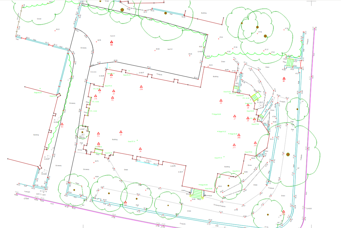
The first step to any construction project is a topographical survey outlining the ground levels, features, and critical measurements of a piece of land for development. It may also include an underground services detection survey so that everyone is aware of any utilities or other obstructions that lie within your site boundary.
Although this would never happen, let’s think about the consequences of not having an up-to-date topographic survey on your site:
• Without topographic base plans there can be no accurate design plans for project reviews with clients and their project stakeholders
• Your planning process would fall apart
• There would be no digital twin in BIM
• Without accurate plans there can be no phased construction programme
• No one would have a scooby doo where the project was meant to be built
• Your project would descend into chaos and as its lead, you would be forgiven for being found in a corner, dribbling, rocking backwards and forwards.
This would never happen though because everyone knows how important topographical base plans and underground services knowledge is to the start of a project despite the fact that our involvement is sometimes quick and small. A topographical survey will support design reviews, planning applications and major decision-making, providing a detailed plan for architects, engineers, and construction experts to utilise and refer to. Powers’ thorough site survey will help to avoid making any assumptions about the site’s size or other land constraints, like ground levels, heights, and the locations of nearby buildings.
To accelerate your construction project’s progress, contact us for a topographical or underground utility detection survey of your site. DM us on our social media or contact the team on 01928 734473 or email surveyors@powersuk.com


