

Going underground
Discovering ‘what lies beneath’ is a key stage of pre-planning for any construction project. By mapping where existing services lie, it’s then possible to design foundations and other utility routes on the site, taking these layouts into account. Underground utility detection surveys are essential for any design and construction project, for a variety of reasons. As well as identifying where subterranean services are located, accurate mapping will ensure the health and safety of contractors on site and the public in the vicinity. It is especially useful on brownfield sites, where buildings may have once stood, but have since been demolished – the underground services may not have been removed so thoroughly – but is equally important on undeveloped greenfield sites also. Digging trial pits or trenches to reveal or confirm what exactly is underground on site can be an unwanted expense and takes time, while underground mapping doesn’t disturb the site.
Underground utilities detection includes cabling and pipework, and are associated with locating the supply of electricity, gas and water, as well as sewage and drainage pipes. They also include all the cabling and fibre optic wires for telecommunications, both ancient and modern. Their configuration will sometimes be noted on historical construction maps and planning submissions, but the exact location will be difficult to ascertain with a precise degree of accuracy. It’s certainly not sufficient to presume that these current buried asset plans are up-to-date and show correctly what is underground, as they are often inaccurate or incomplete. By not having to carry out physical excavations to check, it reduces time spent on site and reduces risk of harm from service strikes during construction.
Experts in the field
To create a sub-surface survey, technicians pull together all available tools and technologies, to create as near to a complete picture of what the site is concealing. These include using statutory records, electromagnetic (EM) locator devices, drawings and other data to locate and map accessible sewers and ducts, and using ground-penetrating radar (GPR) to establish the position and depth of non-metallic, fibre optic and plastic underground services. This will lead to all the underground utilities services being located onto one topographical plan, which will become an accurate, scaled colour-coordinated presentation of the site as it exists and a final utilities survey report for distribution to all interested parties.
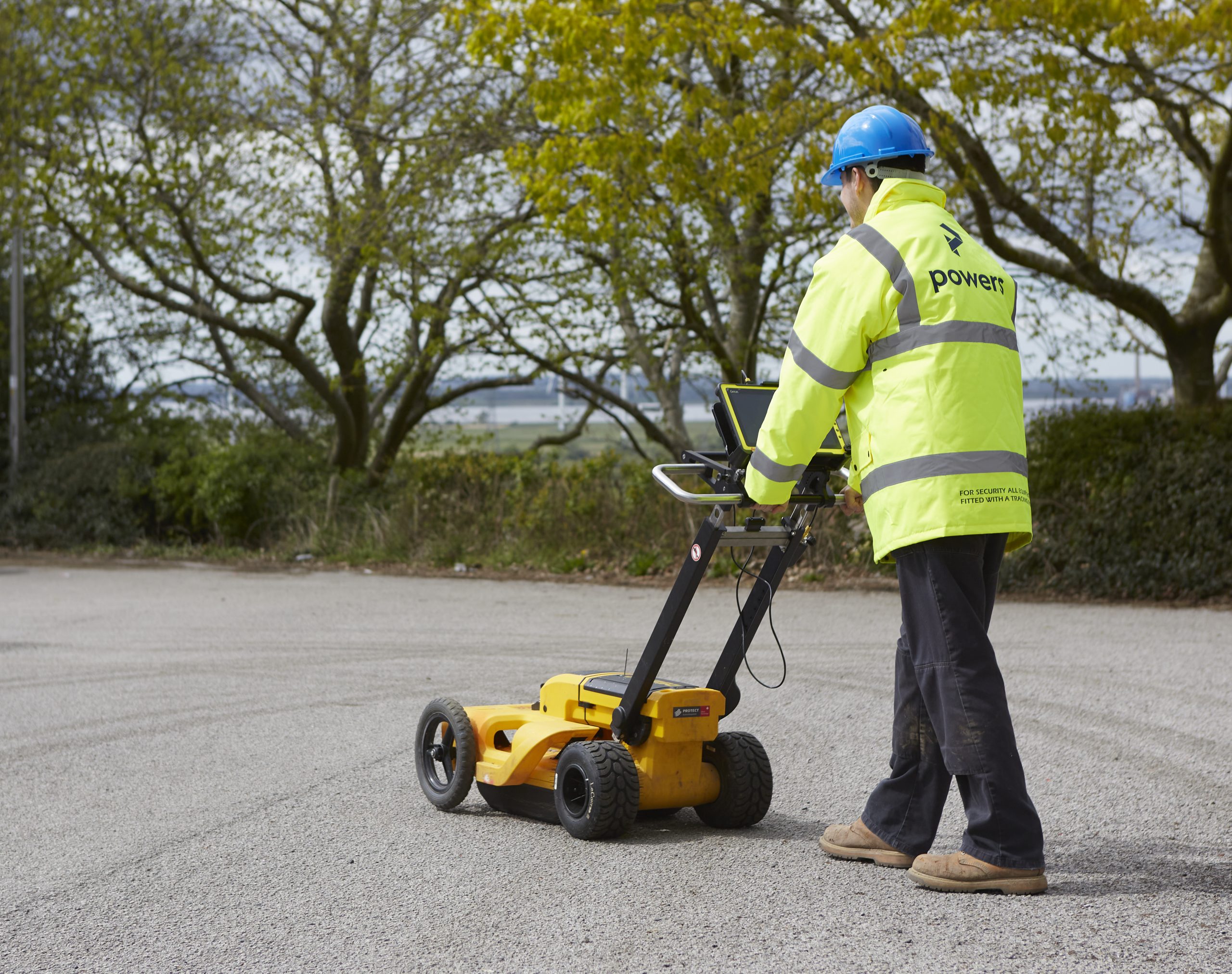
At Powers, one of our specialist areas is carrying out underground utility detection surveys using state-of-the-art technology that reveal the exact depth and location of a wide range of utility conduits and their routes. Our high-precision GPR surveys mitigate against the risk of utility damage, with expert and accurate underground detection. We work to PAS128 standards, which is the specification criteria for underground utility surveys, and we are members of The Survey Association, which ensures our company’s continued development in the delivery of all our survey services. If you’d like to know more about underground utility surveys and how we can help you create one, then get in touch with Matthew Powers or Christopher Snow at Powers Land Surveyors on Tel: 01928 734473.


