

Levels of data
Prior to PAS128, there was no standard in the UK for the way in which a utility survey should be performed. This meant that the service provided from one surveyor to another could vary considerably within the definition of a utility survey. PAS (Publicly Available Specification) 128 was formulated after industry consultation and was implemented in 2014.
There are four category types – designated D to A – and it’s important that you identify which level of survey you require:
PAS128 Survey Category Type D is a Desktop Utility Record Search. This is a comprehensive desktop review of all searchable recorded data relating to the site. This is only as relevant as the data provided and how up-to-date is has been kept. It is the lowest and least accurate method of site utility survey.
PAS128 Survey Category Type C is a survey that plots underground utilities using record data only, but with site visits to verify the exact position of utility routes. Site reconnaissance by a surveyor can identify physical features on the surface, which will hopefully coincide with the desktop survey data. This would include such items power cables, manholes, drainage, and street lighting, which are easily identifiable above ground.
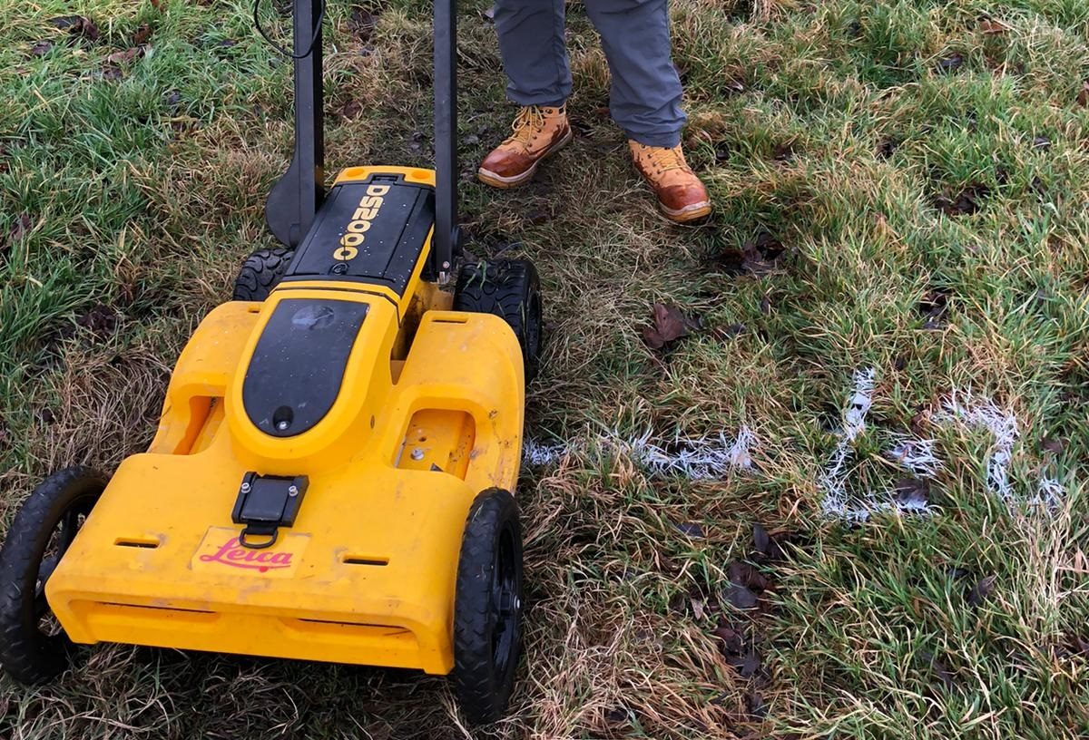
PAS128 Survey Category Type B is detection. This involves an on-site utility mapping survey using specialist geophysical instruments, such as EML (Electromagnetic Location) and GPR (Ground Penetrating Radar). EML is carried out by detecting electromagnetic signals emitted by utilities, either due to the passage of electrical currents in live electricity cables, or generated on the service by the surveyor, who can then mark their locations via the emissions on the ground. GPR transmits a signal into the ground, which is altered by changes in the subterranean environment. This will reveal exactly what lies under the ground, providing an X-ray of the location.
The results are logged and can be read on site or assessed back in our office. These can be combined with the results of surveys C and D, to create an even more detailed overview. We use both EML and GPR, depending on the specific requirements of the project, the size of the site, and the topography and access involved.
PAS128 Survey Category Type A also involves physically carrying out a search of the site and may include actual excavations of the area. Type A is the highest quality survey and together these multi-layered surveys will build a comprehensive 2D and 3D image of the site.
Depth of knowledge
To create these in-depth surveys, our utilities surveyors will look at statutory records and guide drawings of the site, use electromagnetic devices to locate and map metallic buried services, accessible sewers, and ducts. For underground drainage pipes we can use CCTV footage to provide information of the condition of pipework. Using specialist underground mapping technology, we can establish the position and depth of non-metallic, fibre optic and plastic buried services – though even this technology has its limitations and will not pick out and identify every underground obstacle. It is however extraordinarily accurate in most cases. This method will result in the production of a topographical base plan, with the final product being an accurate, scaled and colour co-ordinated presentation of the site underground as it exists today.
Contact us to find out more about our underground utilities surveys and other ways we can help you in your project’s development.


