

Project: City Gateway, Port Salford Extension
Location: Irlam, Manchester
Powers’ involvement: Topographic survey
Project completion: April 2022
Value of the Project: £138m
About the project
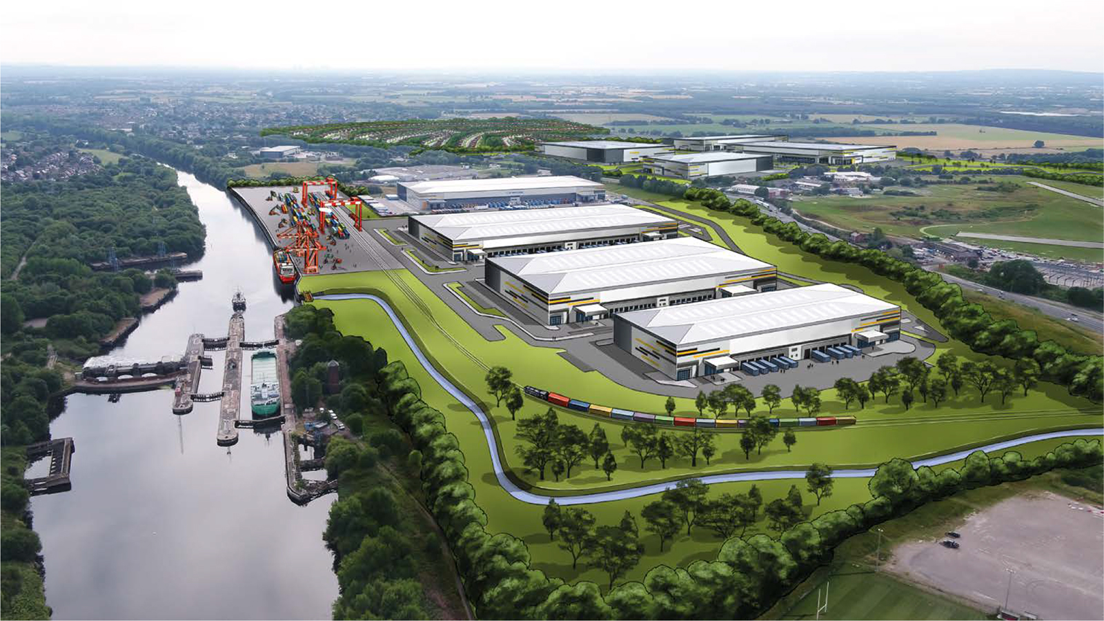
The development framework was submitted to SCC and the Greater Manchester Combined Authority (GMCA) to illustrate the City Gateway development opportunity. This will include an inland port, rail link, container terminal facility and over 4m sq. ft of logistics floor space. It’s expected to support 16 trains a day, whilst also having the capacity to sustain European trains, which are 775m-long.
The extension is expected to:
- Create thousands of new job opportunities for local people
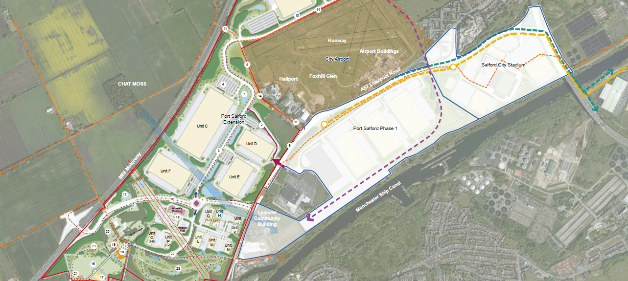
- Form a new junction with the M62 and provide a link road to the A57 dual carriageway and enable quicker access to the motorways
- Reduce costs of import and export for UK businesses
- Save millions of tons of carbon by reducing lorry miles, congestion, and increasing the use of the Manchester Ship Canal. Making it a more sustainable transport link
Port Salford is a key part of the industrial and logistics strategy, due to its location near the motorway. The extension will deliver a multi-modal logistics hub, which comprises 320,000sqm of floor space. This will deliver state-of-the-art logistic facilities, offering an attractive location for a UK-wide based logistics operation.

Our involvement
The site is being developed by the client. Over the years, Powers has supported the client with a variety of surveying services including large topographical surveys and underground utility detection, of North West based projects.
Powers provided a topographical survey of the Port Salford Extension area, including large fields, that are adjacent to the M60 and M62 motorways and the A57. The topographic survey provided defined spatial data, to be used by the client to help them design and plan the development.
The challenges
Programmes for building design and construction have sequences in which tasks are carried out so a project can be completed on time. Programming issues relating to the construction of the project are always a problem for large companies like the client, which is why a topographic survey is needed for work to commence. It allows for changes to be made continuously. A topographical survey is a basis for construction designs, and the topographical drawings will help further down the line of the construction project. The drawing must accurately reflect the ground’s current condition. Once work begins in the area, if the ground doesn’t correspond with the drawing, it would mean the construction process would have to start from square one.
The outcome
The topographical survey provided by Powers enabled construction work to begin. The project will be done in phases and the client is hopeful the entire project will be completed by 2038. The Port Salford Extension will capitalise on and enhance the area’s current connectivity to be able to deliver a UK-wide tri-modal logistics hub. The extension could also include a new Neighbourhood Park, Mossland Park Gateway, and greenspace.
Quote
Matt Stafford, Associate Director Land & Planning, Peel L&P – “Peel L&P has used Powers on various stages of the Port Salford project and has always found them to be helpful and accurate. Part of the reason we continuously use Powers is due to the team’s ability to deliver the work on time and to a high, professional standard.”


