

The level of detail a topo provides can help with the understanding – and create the visual representation – of the site. It will also establish what enabling work needs to be carried out before the start of construction, such as the scale of the earthworks required. However, despite this high level of detail, it is only part of the story. Measured building surveys and underground services detection must always be placed upon a topographic survey for architects and designers to fully understand the building or services environment of the site.
Providing a base plan
Powers will always advise its clients to have a topographic survey carried out, to enable the building or services detail to be put onto it. In some cases, this topo will have been previously created, and can be sent over to be used as the base plan for buildings or services detection. However, problems can arise when two different surveying companies are working on the same project, if they have slightly different control grids or datums. Laying one survey over another then becomes a problem.
A project team will receive far more value from all of the required surveys by asking one survey company to combine the topographic survey, with either the measured building survey or underground utilities (UU) detection – or in some instances, both.
When would you include a measured building survey?
A construction project would benefit from including a measured building survey alongside a topo, when the proposed site includes existing buildings or structures for refurbishment. A measured building survey will support the information gathered by the topo, with information on structural elements and architectural features of existing buildings. This will include external elevations of the building – from the frontage to the rear. A measured building survey also includes the position of walls and doors, steps, columns , window positions, beams, timberwork, the roof detail and guttering. It can even include ornamental features, such as finials, fascias and ornate patterned windows.
Interior elevations may also be required, and these would show things like the precise measurement of doors, walls, beams and windows, even down to fixtures and fittings, such as sanitaryware, light fittings and electric sockets.
The measured data on both the topographic survey and the measured building survey or underground services detection provides invaluable information, which will help ensure that the proposed development all comes off the same control and is linked to the same Ordnance Survey grid.
When would you include an underground utility trace survey?
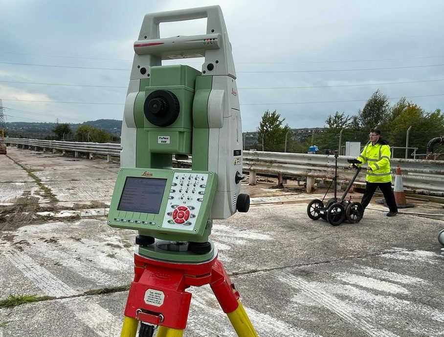
There is a strong argument for including an underground utility trace survey (often referred to as a GPR survey) at the start of all projects. It is very important for the project team to understand what is situated underground, not just at ground level but also in the subsoil and beyond. Ground penetrating radar (GPR) – and electromagnetic equipment (EM) – is used to identify and pinpoint utilities that run across a site and where mains services come into the site. These can include electric cables, water mains, gas pipes, telecoms, drainage etc, which in some cases will have to be checked, to see if they are still live or not. There can also be unknown services, structures, tanks or voids, which can be picked up with GPR equipment.
Bringing it together
All these elements bring challenges for redevelopment, and the more information gathered before the start, will not only save time and money later in the project, but could even save someone’s life. Strikes on some utilities can prove fatal, if they aren’t made safe from the outset.
Once the precise locations of below ground features have been identified, these can then be marked onto the topo to build a complete picture of the entire development site, both above and below ground, before any excavation, piling or drilling takes place. This results in an accurate, scaled, colour co-ordinated presentation of the site as it actually is and ensures that any challenges a site has, can be addressed before opportunities to cause delays develop.
For further information on any of the surveys Powers can provide, contact us.


