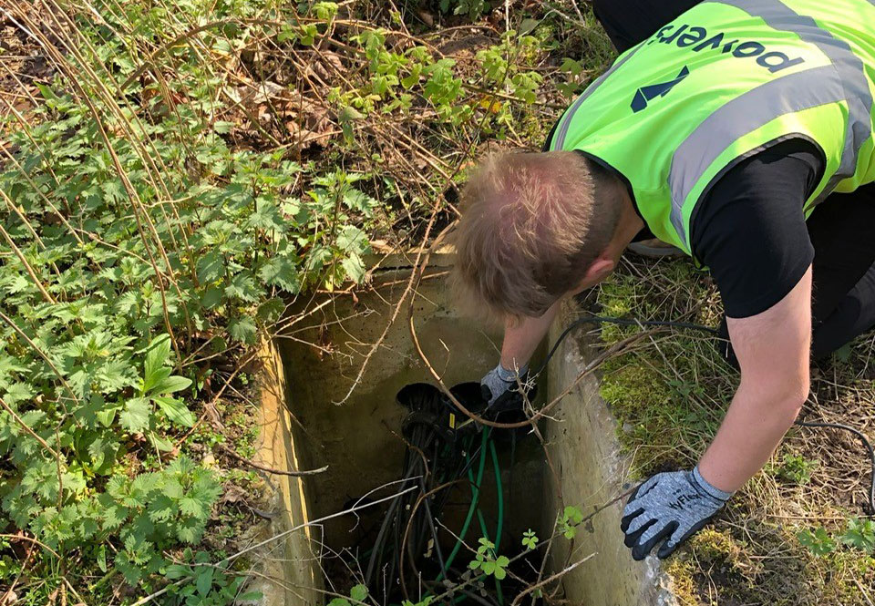
Specification vs certification Specification means we’ll work to a client’s spec, which can be tailored accordingly, simplified or spec’d up. A specification working to a RICS Code of Measuring Practice (6th Edition) spec, for example, means that we will follow a certain specification for carrying out different types of surveys. Certification means we are audited …
Category: News
Visualising future cityscapes – accurate measured viewpoints
Placed in context Urban development is always on the agenda and it’s important to be able to depict how the final results will appear when in situ, in respect to other buildings. We are very involved in this part of the urban development process. As part of our land and buildings surveying services, we offer …
The importance of collaboration
Geospatial surveyors are key collaborators with many different professions. They can be part of many processes and also can contribute to the form and shape of projects beyond their timelines. It’s important to ensure that land surveyors become involved at as early a stage as possible, so that clients can ensure they get the team …
Working to grid: What happens when contractors use different control grids?
The control grid – a single version of truth This single version of truth is generally a control grid. This is a network of horizontal and vertical lines superimposed over a map or building plan and used for locating points within a construction site. The control points are reference points with known coordinates and are …
Using space wisely – surveying, car parks and EV innovation
Points of contact One area, for instance, is the need for consideration being given to the ability to recharge vehicles, to facilitate long journeys and lengthy battery timespans. This has led to a great deal of investment in infrastructure projects that have allowed far greater use of these vehicles on a national scale. EVs are …
Benefits of an as-built survey
The finished article One of the aspects of our work that comes at the end of the construction project is an as-built survey. Also known as ‘as constructed’. This type of survey is usually produced when construction has been completed. They are used to illustrate where buildings, pavements, roads and other features have been built. …
How can I become a land surveyor?
What does a land surveyor do? So you want to become a land surveyor? In all aspects of land or geospatial surveying, you will collect and analyse the data you capture to map what currently exists on a site. This information can be used in construction projects, on design drawings, for civil engineering projects or may …
The importance of innovation in surveying
The price of progress Surveying has evolved over centuries, but the basics of trigonometry, levels and points have remained constants in some form or another. They have been honed and developed, but the end results – such as the creation of new structures, the collection of data and the generation of topographical or underground surveys …
Modelling behaviour – Revit models
What is a Revit model? Revit is 3D building information modelling (BIM) software, widely used by architects, engineers, and contractors to create a digital single version of truth. This can then be used by all disciplines and trades throughout the project, to help complete their work. Revit was created to support BIM and not to …
Land surveying: whatever the weather
Although some of our work is office based, or can be carried out remotely, our data gathering is carried out in-situ. Therefore, surveying is definitely an outdoor activity suited to people who like hiking in rugged terrain and who are used to working in extreme weather. We can literally be working in any location, from …