…
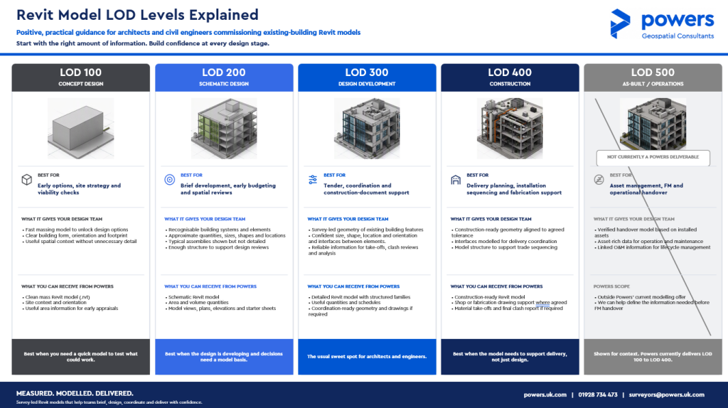
Revit LOD Levels Explained


On 4 March 2026, World Engineering Day for Sustainable Development recognises the vital role engineers play in shaping a smarter and more sustainable future through innovation and digitalisation. …

A new joint article from The Survey Association and Leica Geosystems, Guardians of Precision: the role of surveyors in reality capture workflows, provides a timely and welcome reminder of the critical role professional surveyors play within modern geospatial workflows. The article highlights how digital models can appear visually accurate while still being technically flawed if …
Jack is now halfway through his college course and loving learning about being a surveyor – and even better, putting what he has learnt into practice, out on site every day. “Every day is different, and every site is different. Each project has its own challenges, which are unique to the particular job. This keeps …
Learning together To complete the geospatial survey technician apprenticeship EPA, apprentices must complete three stages – a multiple-choice test, a project report with questions, and an interview with an experienced geospatial assessor supported by a portfolio of evidence. This type of apprenticeship has an integrated qualification, which means that both the qualification and apprenticeship need …

A new lease of life Many city centres have been in decline for a number of years. The popularity of online shopping, high council business rents and rates, and a fall in physical ‘bricks and mortar’ stores have all contributed to a change in the look of many high streets. We are seeing many buildings …

Powers has a reputation for being a geospatial consultancy that delivers accurate, reliable and timely site data. The business achieves this by: 1. Rapid mobilisation with multiple teams across all land surveying specialisms Powers has a team of highly skilled and experienced geospatial surveyors, so the company can respond quickly to meet the client’s needs …

Management of NUAR was formally handed over to Ordnance Survey (OS) in early April 2025. OS now runs the platform on behalf of the newly formed Government Digital Service. NUAR collates data from all underground asset owners into a single map of what is present underground, which aims to significantly reduce the time it takes …
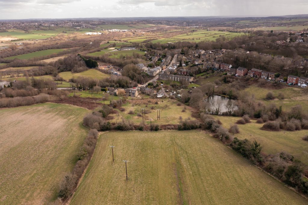
Viable options A site feasibility study is an easy way of looking at the potential for development of a site or existing building. Before any money is spent – even on drawings and designs – a study will map the site and what exists there, prior to any other work commencing. A feasibility study will …

Originally from South Africa, Devon now works in the UK, developing his skills and experience within the profession. His expertise in Revit models and BIM has added an extra dimension to Powers measured building team. He creates models which are an accurate depiction of current buildings. Measured Building Surveys (MBS) map the structural elements and …


