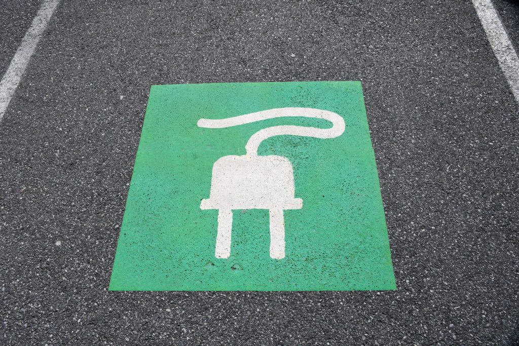
Why champion geography and maths to KS3 children? High school is a great time to start exploring potential career paths. Parents of high school-aged students should encourage their children to pursue career paths that will lead to success and satisfaction. Land surveying encourages creative thinking and provides a sense of accomplishment and pride as surveyors …
Category: Uncategorized
Working with architects, civil engineers, technical and project managers
With our specialised skills, we’re able to provide accurate measurements, mapping of land, buildings and under the ground, providing survey drawings from which new construction plans and projects can be brought to life. Our expertise as land surveyors means we’re able to identify potential geospatial risks, provide the necessary data for design and construction and …
International day of Education
One of the most important aspects of this mentoring program is seeing how our senior surveyors interact with the apprentices. They are patient, kind and friendly, but they also don’t mince their words and tell it how it is when the occasion arises. They present a great example for our young staff members to follow. …
Using drones for land surveying
Drones are revolutionising the way we survey large pieces of land. With a drone, you can cover more ground in less time, and the aerial data collected can provide high-resolution images and detailed maps of the land. From infrastructure projects to land surveying, drones are making it easier to collect data quickly, accurately, and safely. …
Why in-house processing is the way forward
When it comes to working on a project, you want fast turnaround times, as time never seems to be on your side. Some survey companies will outsource their processing to other companies in other countries. This isn’t always a bad thing, as passing on geospatial data processing to an outsourced team means more people can …
The greenest building is the one that already exists
This is a statement we at Powers stand firmly behind. We aim to be more sustainable and love working on forward-thinking projects to create a better environment. As magnificent as new buildings are, we need to think more sustainably. Some buildings are hundreds of years old and can be adapted or retrofitted to bring them …
Level 3 Geospatial Apprenticeship: what is it?
Why become a geospatial land surveyor? Becoming a land surveyor can be an incredibly rewarding career choice. Getting to work outdoors, and also using technical knowledge and problem-solving skills to help people measure, understand, and develop the land. As land surveyors, there will be opportunities to work with a variety of clients such as land …
Greenbelt VS. Brownfield land: a comparison of the two land types for housing
What is Green belt land? Green belt land acts as a divider between urban and rural areas. Green belt policy is a planning tool, and the goal of the green belt policy is to avoid urban sprawl by leaving land permanently open. The green belt land policy was introduced in 1947, by Town and Country …
When is a topographic survey not a topographic survey?
Drone surveys are an excellent way to capture spatial data quickly and effectively, but the finished drawing isn’t always as detailed or specific as a topographical survey drawing. When it comes to revisiting a drawing, years down the line, it’s easy to forget it was not a topographic drawing, to begin with, and therefore one …
Subsidence in commercial infrastructure
What is subsidence? Subsidence is the gradual sinking of the land’s surface, caused by natural processes or human activities such as mining, construction, or underground engineering work. It can also be caused by natural causes such as erosion, geological faults, sinkholes or even tree roots. But in the UK, it’s more often caused by human …