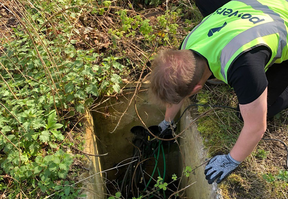
Level 3 Geospatial Apprenticeship: what is it?

land surveyor in a field, using a total station to do a topographical survey

Why become a geospatial land surveyor? Becoming a land surveyor can be an incredibly rewarding career choice. Getting to work outdoors, and also using technical knowledge and problem-solving skills to help people measure, understand, and develop the land. As land surveyors, there will be opportunities to work with a variety of clients such as land …

Read More

Greenbelt VS. Brownfield land: a comparison of the two land types for housing

river running through a greenfield site

What is Green belt land? Green belt land acts as a divider between urban and rural areas. Green belt policy is a planning tool, and the goal of the green belt policy is to avoid urban sprawl by leaving land permanently open. The green belt land policy was introduced in 1947, by Town and Country …

Read More

When is a topographic survey not a topographic survey?

Drone surveys are an excellent way to capture spatial data quickly and effectively, but the finished drawing isn’t always as detailed or specific as a topographical survey drawing. When it comes to revisiting a drawing, years down the line, it’s easy to forget it was not a topographic drawing, to begin with, and therefore one …

Read More

Subsidence in commercial infrastructure

What is subsidence? Subsidence is the gradual sinking of the land’s surface, caused by natural processes or human activities such as mining, construction, or underground engineering work. It can also be caused by natural causes such as erosion, geological faults, sinkholes or even tree roots. But in the UK, it’s more often caused by human …

Read More

Topographical surveys: why are they so important?

a topographic drawing

The first step to any construction project is a topographical survey outlining the ground levels, features, and critical measurements of a piece of land for development. It may also include an underground services detection survey so that everyone is aware of any utilities or other obstructions that lie within your site boundary. Although this would …

Read More

Powers’ Professional Indemnity Insurance is now £5m

Professional Indemnity Insurance (PII) is vital when owning a geospatial surveying business and it provides reassurance to our clients when briefing work to us. Government agencies require their supply chain to have a high level of PII, to cover any eventuality on building projects and we are no exception. We are proud to have PII …

Read More

Complex site surveys

From setting out for construction to topographical surveys, the more complex the better we say. As our survey team are experts in their field, problem-solving is done in real-time on-site.  We love working on complicated projects. For example, we can calculate coordinates for topographical surveys, make sure the roads are dotted, and assign points to …

Read More

Using UAV surveys for Heritage Sites

UAV surveys are ideal if you work in the heritage industry because they allow you to access large sites easily, without affecting the site and avoiding the need for scaffolding or MEWP (mobile elevation work platforms). Historic building surveys done with drones result in clear and precise aerial footage. They can provide a detailed measured …

Read More

Our construction journey

The services we provide will support you throughout your project. We will be with you from: Pre-planning Site preparation On-site construction Post construction What you may not know is, we can deliver all your survey needs throughout the construction journey, by providing you with one quote for multiple survey services. This increases value for money …

Read More