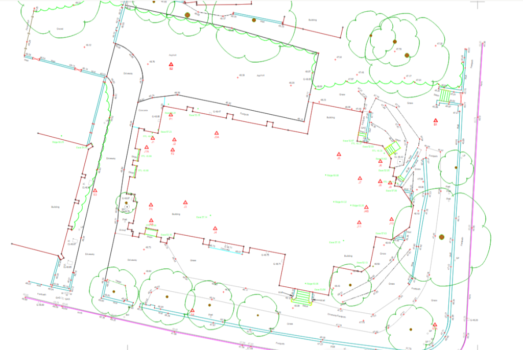
However, it is important to remember that a desktop search does not provide a full picture of what is actually present on site. In order to gain a better understanding of underground utilities without having to break ground, a level B underground utility detection survey can be carried out. If we can support you with …
Could your project benefit from a desktop utility survey?